Showing posts with label geocaching. Show all posts

Thursday, April 11, 2013

under the bluffs


Cumberland River Bicentennial Trail, Ashland City, Tennessee. 

We walked about 4-1/2 miles of the 8 miles of converted rails-to-trails along the Cumberland River. The rock bluffs climb high on one side, the river/lake on the other side. We didn't see much wildlife, but lots of wildflowers and even found a geocache! 


Tuesday, February 24, 2009

still geocaching

Savannah River

We haven't done it in a while, but we are still geocaching! It is by far the best way to see the hidden sights in an area. We have found over 300 caches over the last 4 years.

On Sunday afternoon we followed the GPS to the Hartwell Dam and a little dirt road down to the Savannah River below the dam. The water was a beautiful blue and the... more


So if you can't find us on a Sunday afternoon we are probably out caching, check out our geocaching blog to see what we have found!

Wednesday, April 16, 2008

Friday, February 15, 2008

rewarding


Our Tumblin Falls cache has been voted the 2007 Outstanding Scenic Location cache by the Georgia Geocachers Association. Thanks GGA!

So if you are in the area, come see us and hike to the falls, and see if you can find the cache hidden there.


Awards are making the blog rounds, it seems like we are all in a circle patting each other on the back. Well, who couldn't use a pat on the back once in a while? I am glad to be in this loop, thanks to Bonnie and June.

Thanks to these two blogfriends, awards have been given out to everyone on my list, so congratulations to all, and hope everyone has a rewarding weekend!


Monday, January 28, 2008

refresher course


Sunday dawned clear and not too cold, so I put on my new hiking shirt, jeans, and boots. Buddy soon took the hint and said, "Let me guess, you want to go somewhere, maybe hiking or geocaching?"

We headed over to Carter's Lake to find 3 geocaches there, but really just to get out into the sunshine and fresh air. We hiked the Amadahy Trail around the shoreline, the water and sky were clear and blue. We found this campground (pictured above) which is only accessible by hiking, biking, or boat.

It was very a peaceful and refreshing break, we only saw a few other people all day. Now I am ready to tackle another week of working inside, after I get over being sore from all that hiking!

Sunday, December 30, 2007

Historic Dahlonega


Old Lumpkin County Courthouse, 1836, now the Gold Museum


Dahlonega Public Square, decorated for the holidays


Hall's Block, 1883


Jones House, 1885, now Conner House


We spent a beautiful Saturday in nearby historic Dahlonega, Georgia. We started out the day introducing geocaching to some friends in a new park there, and enjoyed hiking and the great weather.

Later we continued to look for geocaches, several of which were in the downtown Dahlonega area, so we mingled with the many tourists and enjoyed the day.

Dahlonega is the site of the first gold rush in the USA, when Benjamin Parks discovered gold here in 1828.

The Dahlonega Historic Commercial District, listed on the National Register of Historic Places is located on the Public Square of Dahlonega, established in 1833... more here.

Thursday, March 8, 2007

a walk in the park


I found local Camp Jordan Park a couple of miles away. I tried out the two mile walking track one afternoon, watched the ducks in the pond for a while. Sometimes you just gotta get outside.

There are three geocaches located in the park, that is how I found it in the first place. Yesterday Buddy and I went to find the caches, and found another walking trail through the woods. A beautiful sunny day to be outside!

We live in a fast-paced society. Walking slows us down. ~Robert Sweetgall

In every walk with nature one receives far more than he seeks. ~John Muir

My grandmother started walking five miles a day when she was sixty. She's ninety-three today and we don't know where the hell she is. ~Ellen DeGeneres

Monday, October 30, 2006

autumn perspective


We hiked the trail to the top of Black Mountain, we had never been here before, didn't know what to expect, except hopefully to find the hidden geocache there.

While hiking the 2 miles to the top, we would get occasional glimpses through the trees of mountains in the distance. After climbing 700' in elevation from our start at the parking lot, we were rewarded with a 360 degree panorama that was spectacular on this clear crisp fall day.

There's really nothing like sitting on top of a mountain, looking out to the horizon, to put things into perspective and clear your mind.


Climb the mountains and get their good tidings. Nature's peace will flow into you as sunshine flows into trees. The winds will blow their own freshness into you, and the storms their energy, while cares will drop off like autumn leaves. ~John Muir

Monday, June 12, 2006

Rocky Road


Jeep riding on Forest Service roads, up to Nimblewill Gap. At the gap is an intersection, turn left toward Frosty Mountain and on to Amicalola Falls, or go straight to Bucktown (not recommended, that road is even worse than this one).


We were searching for an elusive geocache in the thick undergrowth, and luckily the only critter we saw was a butterfly.


The approach to the Appalachian Trail also crosses here, we saw several hikers with backpacks coming out of the woods down the log steps into the clearing. They seemed surprised to see our vehicle - there is a road here? They were probably thinking - You mean I could have driven here instead of walking?

Hikers as a rule are nice friendly folks. Several stopped to visit, and we explained geocaching to them. They wished us luck and then went on their way up the other side of the gap, up Black Mountain toward Springer.

We left there and went on to search for more geocaches and later attend a geocaching event at nearby Amicalola Falls. Since I work at home during the week and don't get out much (except to go to Wal-Mart), I was looking forward to the social event. (More on my geocaching blog).

It was very peaceful at Nimblewill Gap, but probably not for long, as we met 5 more jeeps coming in as we were going out. As usual on a pretty day, everyone has the same idea, a good day to get out and enjoy the woods.

Tuesday, April 11, 2006

River Road


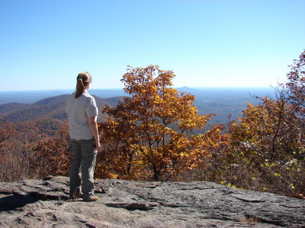
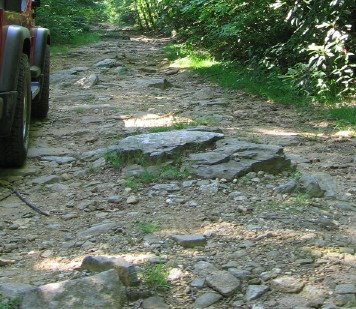
When we first moved to this area when I was 10, my parents would load us up in the car and we would explore this new area. One very memorable drive was down the River Road. Through Copperhill and Ducktown, then down into the gorge beside a rocky river bed, the narrow road followed along the river for several miles. The road signs instead of showing curves showed right turns. The river was not that special, just a lot of rocks. There was certainly no one rafting or kayaking, and there was no place to pull off and see the river, the road was the memorable part.

All that changed with the beginning of the whitewater sport. Whitewater events starting being held on the Ocoee River in 1977.

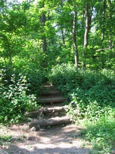
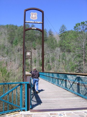
But the road was still narrow and treacherous and access was limited, until the 1996 Olympics came to town. The road is now wider and the area where the Olympics was held is a great park now, with lots of parking, pathways on both sides of the river, two bridges across, a visitor center, picnic tables, 30 miles of hiking trails, all for a $3 parking fee since it is in the national forest.

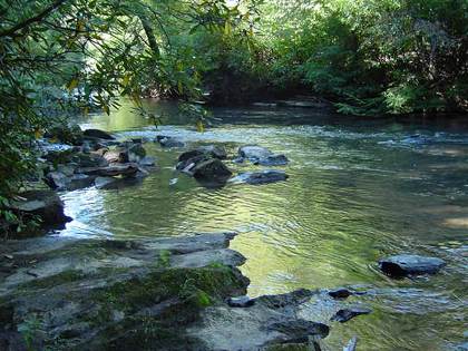
The TVA manages the river for hydroelectric power and for public recreation. They schedule water releases at different parts of the river for whitewater events and on weekends. At the Olympic site, usually Saturdays are very busy, with the water running high and fast, with brightly colored rafts and kayaks, lots of spectators on the sides, the whooping and hollering of the rafters, the occasional ambulance adminstering to the injured. Sundays are tamer, the water is flowing low and slow, families with small children can get out and play in the water and rock-hop, have picnics on the river bank.

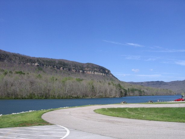
We went up there this past Sunday to do some hiking and geocaching, and it was pretty quiet, since the water was low there were no rafters at this section, and since the weather was cool, no kids playing in the water. We drove on down to the next dam, though, and there were all the rafters and kayakers! It is never too cold for those die-hard whitewater folks.

The water release schedule is posted on the 
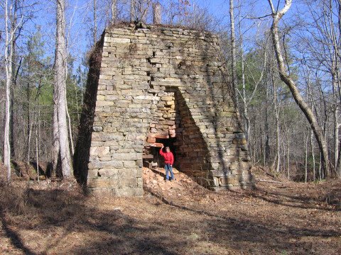
website. There is not much evidence that the Olympic games were ever here, other than the sign. The grandstands are gone. There is the occasional manhole cover that says 'communications'. The only building is the visitor center, now used by the forest service. It is built out of native rock and wood, fitting into the landscape nicely.

The first two pictures were taken this past Sunday, when the river was tame. The one with the raft was found online, but is of the same stretch of river when the water is high.

The River Road area is now a great (inexpensive) way to spend a day, whether you want the excitement of whitewater or a lazy river, participation or spectator, hiking, mountain biking, getting your feet wet, or just sitting in the sun.

Monday, April 3, 2006

Tennessee waters

Tennessee Aquarium, Chattanooga, Tennessee

Beautiful weekend, just had to get out of the house. We have never been to the new Georgia Aquarium, and even got free admission for Christmas, but way too many folks had the same idea, checked online, all booked up for Saturday. So we headed north to Chattanooga, which is closer than Atlanta and a lot less crowded. We visited the Tennessee Aquarium - we had been there before and always enjoyed it, and now they have added another building.

We then drove to nearby Raccoon Mountain, a TVA project on the Tennessee River. We had a nice visit with the couple who volunteer at the visitor center at Raccoon Mountain, both retired from TVA. We learned all about the making of hydroelectric power at this facility. They apologized for not being able to take us down the 1000' elevator to see the actual power plant deep under the mountain, but since 911 that tour has been closed. Did some hiking and caching.

Tennessee River Gorge at Raccoon Mountain

Thursday, March 30, 2006

listen... is that banjo music?

The directions were to Cashes Valley, deep in the mountains, once a community years ago, but now nothing left but an old cemetery. There was even a poem written to direct us to the spot:

On Boardtown to Bushy Head, Cashes Ln, Cashes Rd, Left, Left, Left.
Is a forest dense, lush and green, through which the Fightingtown dashes,
Among the rocks, the reels, the logs, the gorgeous water flows.
by flower, fern, doe and fawn, ridges high among the morning fog.
A one lane road, narrow and winding, into the natural beauty it goes.
On to your destination, a cache, hidden near a Garden of Stone.
Placed in a home of man made comfort, for birds of radiant blue.
The cache is marked upon a lift up door, an emblem familiar to you.


Yes, we were off geocaching again, this time on a beautiful Sunday, taking along Carrie and Kyle.

We followed these directions, off the main highway, onto the paved secondary roads. The paved road changed to gravel. The road got more and more narrow. We were anticipating fording Fightingtown Creek 4 times according to the directions. With each ford the road on the other side got smaller. The water was clear as only it is way out in the mountains where no people are there to pollute it. The rhododendrons covered the steep creek banks. At the prescribed place according to the GPS, there it was, an old cemetery. We got out and Kyle promptly found the cache, hidden in a wooden 'birdhouse' put there by the cache owner. From here, we walked up the road a little farther to find the next cache. We could see the end of the road up ahead, with a gate across.

We searched the bank on one side of the road, but Buddy called out 'found it' on the other side of the road, by the creek. Just as he was pulling it out and opening up the box, a truck drives up behind us. We often meet people while out caching, nice folks who share our love of nature, or they wouldn't be out in the woods like us.

This was NOT the case today. Yes, we were 4-1/2 miles down a one lane narrow dirt DEAD END road out in the middle of nowhere, after fording the creek 4 times, and we ended up face-to-face with a one-toothed local feller who was NOT happy at all with us. Even though we were on the road, according to him, we were trespassing and he was just looking for the right opportunity to make an example of us cussed trespassers.

If you have ever seen the movie, Deliverance, it might help you picture the pickle we found ourselves in. It was filmed here in north Georgia, you know.

My husband has a great Southern accent, and blends in pretty well with the locals. Today, he turned the twang up a notch and diplomatically talked us outta getting shot. We promised to take the offensive box out with us and return it to the rightful owner and post a message on the website to warn folks not to come out this way again.

Needless to say, we high-tailed it outta there. On the way out that narrow road, my thoughts were, 'Can't this Jeep GO any faster?' After many turns later, we finally reached the main highway. We turned left to go farther north for more caching, and Kyle said 'Good, you didn't turn toward home, so he won't know where we live in case he is following us!"

All turned out okay in the end, but that was way too much excitement for a Sunday drive in the mountains. I can still hear the banjo music...


Y'all Come Geocaching

Monday, February 27, 2006

work in progress...

Y'all Come Geocaching

Starting a new blog to chronicle our geocaching adventures. We have been geocaching for a year now, and I will go back and add all the past memorable caches as soon as I can.

What is geocaching?

A hobby/sport finding hidden objects with a hand-held GPS unit.

How does geocaching work?
  • A Geocacher carefully chooses a location and hides a container which has been filled with items to trade and a logbook. He determines the coordinates for the container cache (latitude and longitude) by using the hand-held GPS unit. He then registers his new cache on GEOCACHING.COM to share it with the rest of the world

  • Another Geocacher can look up caches by entering a zip/postal code into GEOCACHING.COM. After receiving the coordinates and other information from the website, this Geocacher uses a hand-held GPS to look for the cache. The GPS receives signals from the Global Positioning System satellites to give the user their current longitude and latitude. However, the Geocacher has no idea of the altitude of the cache location or the terrain or what kind of structure the cache container might be hidden in. This is part of the challenge of finding the cache!

  • The finder takes something from the container as a memento of their visit, leaves something for the next player, signs the logbook and returns the container to its hiding place. Later, they will log their visit on GEOCACHING.COM so that others can read about their adventure.

Friday, February 24, 2006

mud on the tires


The old man is heading home after working out of town for 2 weeks. There is a new cache out by the lake that no one has found yet. Do you think he is up for a little jeep riding and geocaching?


There's a place I know about where the dirt road runs out
And we can try out the four-wheel drive
Come on now what do you say
I can hardly wait to get a little mud on the tires

Stake out a little piece of shoreline
I've got the perfect place in mind
It's in the middle of nowhere only way to get there
You got to get a little mud on the tires

And then with a little luck we might just get stuck
Let's get a little mud on the tires


- from the song Mud on the Tires by Brad Paisley

Wednesday, February 15, 2006

puzzling

Do you like puzzles? I like all kinds of puzzles. Crossword puzzles, jigsaw puzzles, logic problems, sudoku, word puzzles, math puzzles. I am not necessarily good at any or all of these, but I enjoy trying to figure them out.

Geocaching sometimes has a puzzle to solve in order to find the cache. These puzzles are created by folks who must be rocket scientists, because I rarely can solve any of the geocaching puzzles. But this weekend with the help of Buddy, we figured one out. Here is the puzzle. If you figure this out, you can go find the cache.

Anyway, we were the first ones to figure it out and after two trips to the designated place, we were the FTF!!! (That's first to find in geocaching language - it's a big deal to be the first to find a newly placed cache). We rarely are the FTF, as there are some die-hard geocachers out there, and as soon as a new cache is published, they are there.

Can you find the hidden objects in the first two posts of this month?

Friday, February 3, 2006

firefly hunting

Did you ever catch fireflies when you were younger? It was a lot of fun, finding and catching the elusive glowing bugs.

We went hunting fireflies the other night, We went night caching! We have been geocaching for a year now, always in the daytime, but there was a new cache in the area that was set up to do at night. I was leery, but it did sound exciting. It is in the Dawson forest, home of the abandoned nuclear reactor, and I agree with another cacher who posted that 'these woods are spooky'. Add to that the fact that we had to go all the way to the end of a dead-end narrow dirt road to park, passing other vehicles on the way that were parked on the side, wondering where the drivers were, and what they were doing there (do you hear banjo music?). Anyway, we arrived well before dark, not sure what to expect, so we got out and investigated the area.

I did not know what to look for, but Buddy had done his homework. For night caching there are small reflectors (fireflies) put out in the forest to guide you along, which can be seen with a bright flashlight. Once we knew what to look for, we spotted some of the fireflies in the daylight, and after combing the area, actually found the cache. We took a very special cache prize - the coveted white jeep travel bug. (Jeep Corp is in with geocaching.com, as it takes a 4-wheel-drive vehicle to get to a lot of caches.) We stuck around til dusk to see how the fireflies actually looked, very spooky indeed.

Tuesday, January 31, 2006

Confederate legacy

This is the ruin of a 19th century iron smelter found near Stamp Creek in the Etowah river valley in north Georgia. It is in a protected forest, wildlife management area. We anticipated a 3 mile hike round trip, but when arriving at the parking area found the gate open, so we just drove to within 200 feet of the furnace.

This furnace is one of more than a dozen iron smelters that operated in this area in the mid 19th century to provide iron for the Confederacy. The ruins of six of the furnaces still exist, and two more ruins are submerged deep below the surface of Lake Allatoona.

Some of these furnaces were destroyed by Sherman during the Civil War. A few resumed operation after the war, but all were shut down by 1880.

We tried to visit another of the six remaining furnace sites, and were looking forward to another hike, it being described as - "This is a remote area, so it would be a good idea to let someone know where you are going, especially if you go alone." The drive toward the site provided breathtaking views of the mountains, and lots of virgin timber, BUT upon arriving at the designated coordinates, we discovered not a remote area, but the construction site of the new Veteran's Administration Georgia National Cemetery. Yes, almost 800 acres being stripped of trees. All that could be seen was red Georgia clay and giant earthmoving machines. It was sad to see the land being abused, and thinking of all the animals being displaced that used to call it home - deer, bear, turkeys, etc.

I realize cemeteries are a part of our culture, but just think, when all the baby boomers are dead and buried, will the US just be one big cemetery? Anyway, I am hoping that they will preserve the historic furnace on the site and incorporate it into the landscape of the cemetery, I believe it would be an appropriate addition to the plan.

Wednesday, January 11, 2006

A radiating experience...

One of the perks of geocaching is learning about the history of our area. Last summer we discovered Dawson Forest, a local wildlife management area, which usually means beautiful undeveloped forest, hiking trails, jeep riding, clear unspoiled creeks, etc. Unless it is hunting season - hence the 'wildlife management' part. Then you don't want to be in there unless you are hunting. The boundary of this forest begins 5 miles from here, and it stretches for 10,000 acres. There were several geocaches in this forest, one of which was named Reactor Road.

Of all the things you would not expect to find in a protected forest area is a nuclear reactor, but that is what is there, or the remains of one. It seems this tract of land was formerly owned by the Lockheed Aircraft Corporation, who operated the Georgia Nuclear Aircraft Laboratory (GNAL) which, among other things, tried to develop a nuclear powered aircraft. A small 10 megawatt reactor was used in radioactive material research for about 12 years.

The area has been continuously monitored for radiation, and no health or safety threat has been found. Three acres out of the 10,000 acres continue to be restricted from public use as a precaution. The hot cell building area and cooling-off-area are restricted with fences and posted due to levels of Cobalt-60 and Europium-152.

We were wary of hiking through this area, but when entering the area, there were lots of folks enjoying the forest, riding horses, jeeps, hiking, etc. We passed the abandoned buildings with their warning signs. We wound around the area and finally found the cache. According to the information page on the cache, it is only 18 miles from our house (as the crow flies, of course).

There are a couple of new caches just placed in the area recently. One is by the Etowah River which winds through there. The other is named Firefly Treasure Hunting, which must be done at night, and which apparently involves something that glows in the dark... I guess just as long as we don't glow in the dark after finding that one, we will be going after it soon.

It is still puzzling and unsettling to find out that this has been here all these years, and we had never heard of it. It is even more puzzling why anyone would want to hunt and eat animals who live there (?). Reminds me of the story of the 3-eyed fish found in the river near the Springfield Nuclear Power Plant where Homer works on The Simpsons.

Wednesday, January 4, 2006

Confederate cannonballs

This building is John B. Gordon Hall in Lafayette, Georgia. The structure, completed in 1836 as the Chattooga Academy, is Georgia's oldest brick school building and is named after Confederate Gen. John B. Gordon, who attended the school as a child and also served as governor of Georgia.

The Civil War (or War Between the States) dated 1861-1865. The North (Union/Yankees/them) fought the South (Confederates/Rebels/us).

Confederate Gen. Braxton Bragg made Gordon Hall his headquarters in September 1863. Bragg sat under an oak tree in front of Gordon Hall as he planned his attack on Union forces at Chickamauga. A stack of cannonballs honors him.

spring